
Land survey services form the backbone of informed property ownership, infrastructure planning, and...
A Complete Guide to Professional Local Surveyors Services for Property Owners
A Complete Guide to Professional Local Surveyors Services for Property Owners
5:37
Owning property is more than just purchasing land. It is important to know the precise boundaries, dimensions, and characteristics of that territory to avoid disputes, guide construction, and be compliant with laws. Professional local surveyors play an important role here. They provide precise measurements and detailed reports, which can assist property owners in making decisions.
Whether you are buying land, developing a property, or resolving a boundary concern, professional land survey services ensure that every detail of your property is documented with precision. In this guide, we will explore how surveying works, why it matters, and how property owners can choose the right experts for the job.
Understanding the Role of Local Surveyors
Professional local surveyors are experts who survey and map the land to establish the true boundaries and physical features of property. Their efforts integrate fieldwork, historical data, and technology to generate an accurate survey of the land.
Homeowners rely on them to verify property boundaries, builders depend on them to determine the correct layout in constructing property, and real estate professionals use them to obtain property details during business deals.
Since ownership of property is closely related to legal records, hiring a skilled local land surveyor is the way to make the data related to your land accurate and dependable.
What Land Survey Services Include
Types of surveys offered by professional land survey services include those that provide specific information regarding a property. Every form of survey fulfills a different purpose and will depend on the requirements of the property owner or project.
The most frequent types of services are:
- Boundary Surveys - Determine the exact property line and establish possible encroachments.
- Topographic Surveys - Map physical objects like elevation, trees, drainage, and terrain.
- ALTA/NSPS Surveys -detailed surveys are often required for commercial real estate deals.
- Construction Surveys - Construction Surveys are done to make sure that buildings and infrastructures are in the correct location.
- Elevation Surveys - Provide information required to determine flood zones, as well as for insurance.
A reputable land survey firm can assist the property owners in selecting the appropriate type of survey depending on their requirements.
Why Property Owners Need Professional Surveying
Many property owners do not consider professional surveying until they are faced with a challenge. Hiring knowledgeable local surveyors will help eliminate numerous common challenges of property ownership.
Confirming property boundaries is one of the primary reasons why surveyors are hired. The misunderstanding of boundary lines may lead to problems or even legal issues with the neighbors. A survey by a professional clearly defines the property boundaries and gives official records.
Land survey services are also used to facilitate construction projects. Builders need accurate measurements prior to laying down structures, driveways, or fences. Without a proper survey, construction projects may violate property or zoning laws.
The Value of Working with Local Land Surveyors
There are a number of benefits of hiring qualified local land surveyors for property owners. Local professionals know the local land records, zoning issues, and geographic conditions that can affect a survey.
Since they work in the area, they usually can access historical property data and local government records faster. This enables them to accomplish surveys more effectively and accurately.
The other benefit of employing local surveyors is accessibility. The property owners will have a chance to speak to the representatives directly, who will be aware of the needs of the community and the local real estate market.
Technology Used by Modern Land Survey Companies
Modern surveying has evolved significantly with the use of advanced technology. A professional land survey company now combines traditional fieldwork with modern digital tools to improve accuracy and efficiency.
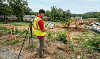
The Global Positioning System (GPS) equipment is used to assist surveyors in recording extremely accurate geographical coordinates. Buildings and terrain can be mapped in detail, using laser scanning technology. Drones are sometimes used to collect aerial information on large areas or inaccessible locations.
These tools assist local land surveyors in creating detailed maps, generating results faster, and creating highly accurate measurements. This means the property owners will have access to reliable information to aid in planning, development, and the management of the property.
Conclusion
It is important to know the boundaries and the physical properties of your property to protect your investment. Professional local surveyors have the knowledge and equipment to offer accurate land measurements and sound documentation.
From real estate purchases to construction planning, local land surveyors ensure that owners are provided with clear and accurate information concerning the property. Having a reliable land survey company helps prevent conflict, supports project development, and ensures that decisions about the property are based on verified data.
For accurate and reliable land survey services, trust the experienced Exacta Land Surveyors LLC team to deliver precise results with trusted local surveyors you can depend on.

